

Updated convenient map presented for Tashkent metro
An updated scheme of the Tashkent metro lines has been announced. This was reported by Zamin.uz.
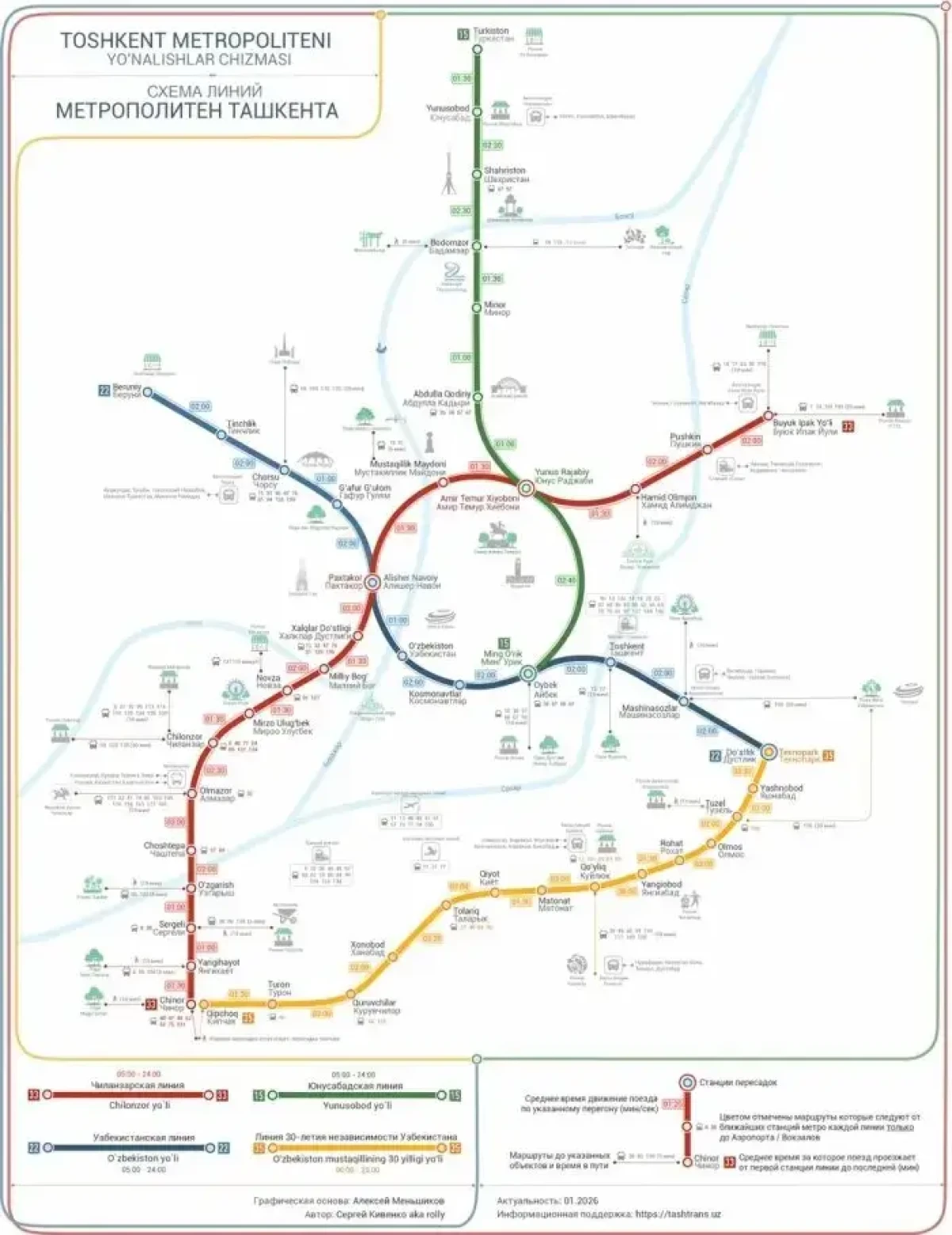
In the new scheme, travel times between stations have been precisely calculated and are even shown down to the seconds. This helps passengers plan their travel schedules in advance and manage their time efficiently.
One of the most important features of the new map is that it not only shows the distances between stations but also answers the question "Where can I go after exiting the metro?" The map includes additional information about parks, markets, sports facilities, and suburban bus stations located near the stations.
As a result of this update, passengers can plan their routes more conveniently and efficiently, as well as reach their desired destinations without wasting extra time. This update will make using the metro easier for both city residents and visitors.