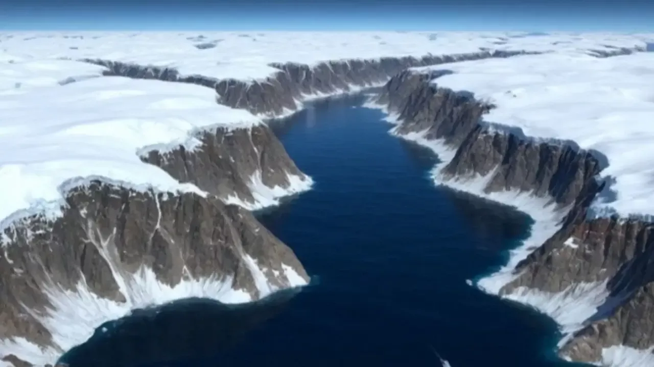
332 Underwater Canyons Discovered Beneath Antarctica
332 huge underwater canyons located beneath the Antarctic ice have been discovered. This was reported by Zamin.uz.
An international team of researchers from the University of Barcelona and Cork University College succeeded in creating the most complete and comprehensive catalog of underwater canyons in Antarctica. According to information published in the Marine Geology journal, scientists identified a total of 332 large underwater canyons on the seabed.
Some of them are located deeper than 4000 meters. Previous studies did not have data on such a number of canyons.
Thanks to new mapping technologies, at least five times more canyons were identified compared to previous results. According to scientists, underwater canyons play an important role not only in geological structure but also in nutrient cycling and the global climate system.
Although Antarctic canyons resemble other underwater canyons, their size and depth are much greater due to the millennia-long influence of polar ice sheets. The research results showed a significant difference between the underwater structures of East and West Antarctica.
The canyons in East Antarctica are complex, multifaceted, and U-shaped, formed as a result of continuous ice movement. The largest and most impressive canyons are located in this area, starting from various points of the continental shelf and merging into a single large channel.
The canyons in West Antarctica are shorter, steeper, and V-shaped, explained by the historical formation processes of the ice sheet. This confirms that the ice sheets in East Antarctica have formed over a long period.
The discovered canyons facilitate the circulation process between deep ocean water and the continental shelf. This process contributes to the formation of Antarctic bottom water and forms the main foundation of global ocean circulation.
However, scientists warn that warmer waters reaching the coastline through the canyons may cause faster melting of ice shelves. If the ice shelves weaken or collapse, continental ice sheets will flow into the sea more rapidly.
This could lead to a rise in global sea levels. The discovery was made based on an international bathymetric map of the Southern Ocean.
The map was prepared at a scale of 500 meters per pixel, considered four times more accurate than previous maps. Additionally, scientists developed a semi-automated identification method and a special GIS script to calculate the morphometric parameters of the canyons.
Researchers emphasize that current climate models do not fully account for complex processes. Therefore, climate change forecasts are not sufficiently accurate.
To correctly assess the real consequences of global warming, more detailed seabed mapping and model development are necessary.